




























































































































































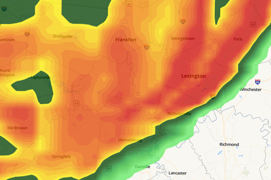
Severe weather is expected to hit Lexington over the next four days, starting late Wednesday, April 2.
According to an email sent by University of Kentucky President Eli Capilouto, hail, tornadoes and damaging winds are forecasted to hit Lexington.
In the case of severe weather, individuals should seek shelter immediately, avoid outside doors and windows, and have emergency alert systems turned on to notify of storms overnight, the email said.
Gov. Andy Beshear activated the Kentucky Emergency Operations Center and units of the Kentucky National Guard to stand ready to respond, according to WKYT.
“We’re really concerned about people’s safety,” Beshear said. “Especially in the overnight, because when storms or tornadoes hit while people are asleep, that’s sadly when we’ve lost the most people.”
According to the National Weather Service, “life-threatening” flash floods are expected to hit Western Kentucky on Thursday, April 3.
“Tornadoes are expected, and I know that’s tough to hear. And we are most concerned about the area of Western Kentucky that has gotten hit far too much, as well as a wider area of Western Kentucky,” Beshear said.
Beshear said the tornadoes expected could reach levels as high as 5, the most severe EF level a tornado can have, according to the National Weather Service.
According to WKYT, drivers are urged to check traffic conditions before traveling at GoKy.ky.gov.
This is the second instance within the past four days of severe weather impacting Lexington as a series of storms move through the United States.